Burrows Park (Park) District Mining Information

Hinsdale County

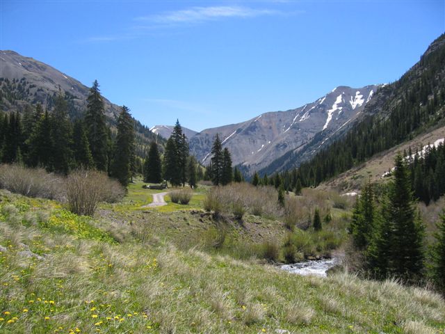
Burrows Park District (aka Whitecross District; aka Park District)

This district is possibly an amalgamation of several districts, but at least has several names. Henderson provides very a very specific location for the Park District, listing 16 sections in three different townships that appear to be the same as other descriptions of the Whitecross/Burrows Park District. Dunn (2003) indicates that the Burrows Park District may have originally been known as the Park District, which seems to fit with Henderson’s description. She notes that Hinsdale County was divided into six districts by the state legislature in 1893, of which the Park District was one, along with the Carson, Cimarron, Galena, Lake, and Sherman Districts. Mindat.org (Sep 2015) considers the Burrows Park, the Park and the Whitecross to be the same district, a convention we follow here.

Vanderwilt (1947) considered the Burrows Park District, which he described as sitting at the head of the Lake Fork of the Gunnison River, to be a continuation of the mineralization of the Silverton area. Wilson and Spanski (2004) aggregated the Burrows Park District in with eight other districts as the “San Juan Mineralized Area.” The connection is that they appear to lie within the San Juan caldera of Steven and Lipman (1976). (The other districts in this grouping are the Galena/Henson Creek, the Sneffels, South Ouray, Eureka, Telluride, Ophir, Red Mountain and Lower San Miguel, of which the Galena is in Hinsdale County.)

The geology consists of tuffs and flows associated with the Oligocene San Juan caldera complex, with an outlier of Precambrian granites in the middle (Vanderwilt, 1947). Mineralization consists of “filled fissures grading into replacement types” of chalcopyrite ore, sphalerite-galena ore or gold-silver ore with small amounts of lead and zinc (Vanderwilt, Ibid).

Eberhart (1969) discusses the three settlements that arose around Cinnamon Pass – Whitecross, Tellurium and Sterling. He indicates that the harsh winters and associated transportation problems inhibited both the mines and the towns.

Mines listed in the district (mindat.org; Eberhart, 1969; Dunn, 2003) include:
 Allen Dale2
 Bon Homme Tunnel1, 2
 Burrows Park Group1
 Champion2
 Cleveland Group (Hilluron Millsite; Ida; Lock Lommond)1
 Cracker Jack2
 Dewey1
 Gavin Pipe Occurrence1
 Gnome Mine (Bull Run; Bull Run No. 1; Unpatented Claims: Sydney Nos. 1-3;
Gnome Nos. 1-26; Patented Claim: Gnome)1
 Goodwin1
 Goodwin’s Creek1
 Illinois Boy Mine (Patented Claim: Illinois Boy)1
 Isolde Mine (Belcher; Baltimore; Isolde)1
 Little Sarah2
 Monticello Mine1
 Mountain King2
 Napoleon Mine (Patented Claim: Napoleon)3
 Ohio Mine1
 Onida3
 Park View Mine (View of the Park Mine; D & N Lead Mining Company Nos. 1-4)1
 Providence2
 Seward County Mine (Patented Claim: Seward County)1
 Silver Star Mine (Patented Claim: Silver Star)1
 Tobasco2
 Troy2
 Undine3
 Whitecross Mountain1
Notes: 1 Mines listed in mindat.org, September 2015.
2 Mines listed by Eberhart (1969), as located near the settlements around Cinnamon Pass.
3 Mines listed by Dunn (2003).
Minerals listed in the district (mindat.org) include:
Brochantite
Calaverite
Calcite
Chalcopyrite
Galena
Lillianite
Molybdenite
Opal var: Opal-AN
Platinum
Pyrite
Quartz
Sphalerite
Tetrahedrite
References:
Dunn, Lisa. 2003. Colorado Mining Districts: A Reference. Colorado School of Mines, Golden, Colorado.
Eberhart, Perry. 1969. Guide to Colorado Ghost Towns and Mining Camps. Fourth, revised edition. Swallow Press, Athens, Ohio.
Henderson, C.W. 1926. Mining in Colorado, a history of discovery, development and production. U.S. Geological Survey Professional Paper 138.
Steven, T.A. and Lipman, P.W. 1976. Calderas of the San Juan Volcanic Field, Southwestern Colorado. U.S. Geological Survey Professional Paper 958.
Vanderwilt, John W. 1947. Mineral Resources of Colorado. Colorado Mineral Resources Board, Denver, Colorado.
Wilson, A.B. and Spanski, G.T. 2004. Distribution of Mines and Mineralized Areas in Bankey, V., ed. Resource Potential and Geology of the Grand Mesa, Uncompahgre, Gunnison National Forest and Vicinity, Colorado. U.S. Geological Survey Bulletin 2213.
www.mindat.org, accessed September 2015.

This information is from the Colorado Geological Survey website at http://coloradogeologicalsurvey.org

Lake City (Lake) Mining District Information

Hinsdale County

Lake City District (aka Lake District; aka Lake Fork District)

The Lake City District has been identified as the Lake, the Lake City and the Lake Fork District. These districts are occasionally differentiated, but here we include all as the same district, extending south to Lake San Cristobal.

The Lake District was one of the six districts into which the Colorado legislature divided Hinsdale County in 1893. (The others were the Carson, Cimarron, Galena, Whitecross and Sherman Districts.) The district occupies the Lake City, Uncompahgre Peak and Redcloud Peak quadrangles.
Lake overlaps (or blends into) the major district to the west, the Galena or Henson Creek District. Mindat.org separates the Lake and the Galena into two districts. The seminal work on the area – Irving and Bancroft (1911) does not distinguish the different districts, but rather discusses mines in the vicinity of Lake City.

Mindat.org and Dunn (2003) list the group of mines (the Hidden Treasure, Ute and Ulay) among the most famous and productive in the Lake City District. However, Irving and Bancroft (Ibid) lists them among the “Henson Creek Mines,” which implies Henson Creek (Galena) District. Vanderwilt (1947) places these mines in the Galena (Henson Creek) District also, and provides a structural distinction between the two districts, noting that a down-faulted block lies between Henson Creek and Lake Fork. We have chosen to make the distinction as mindat.org does to make referencing the mines easier for the reader.

Irving and Bancroft (Ibid) distinguish a group of mines as the San Cristobal Group, south of Lake City – a geographic distinction that we believe places those mines in the Lake City district.
The geology of the Lake City District is typical of the San Juan Mountains. The district sits within the caldera fill on the northeast margin of the Lake City Caldera (Steven and Lipman, 1976; Wilson and Spanski, 2004). Units include Oligocene quartz latite and andesitic flows and breccias of significant lateral extent, plus more localized flows; the Bachelor Mountain and Carpenter Ridge tuffs, the Fish Canyon tuff, the La Garita tuff, the Henson and Burns formations, the Sapinero Mesa, Eureka and Dillion Mesa tuffs along with silicic lavas (Day et al., 1999). Generalized descriptions are also available in Sanford et al. (1987).

Mineralization was described generally by Vanderwilt (Ibid) as vein mineralization continuous with that of the Silverton area. Bove et al. (2000) distinguish 23 Ma precious metal-bearing barite veins and older base-metal veins. Irving (1905) and Irving and Bancroft (1911) provide a detailed descriptions of the rocks and mineralization.

Some top-producing mines include the Golden Fleece (nee Hotchkiss) mine, discovered in 1874, which produced $1.4M in metals (Henderson, 1926). The Pelican Mine produced off and on from 1891 to 1960; Irving and Bancroft (Ibid) report freibergite, pyrargyrite and galena as the main minerals. The Fanny Fern Mine produced silver from tetrahedrite, reporting 74,000 ounces of silver and 65 ounces of gold.

The Black Crook Mine operated off and on until 1953. The Contention Mine was another major producer.

The Ute and Ulay veins are names that always appear in relation to the mines and deposits of the Lake City area. The Ute was the most productive and important of all the mineral veins in the district (Irving and Bancroft, Ibid). The vein was traced for 2,700 feet along outcrop. The vein described an arc, concave to the northwest, averaging four feet in width, but pinching and swelling and occasionally splitting. The vein sequentially filled first with quartz, then rhodochrosite/tetrahedrite/galena and then more quartz. Later movement shattered the vein material and deposited more quartz and barite. The ore mineralization was (presumably, because it was mostly gone even before Irving and Bancroft visited) argentiferous galena with subsidiary tetrahedrite, sphalerite, pyrite and enrichments of ruby silver (proustite/pyrargyrite – Ag3AsS3- Ag3SbS3). Further details are available in Irving and Bancroft (Ibid).

A unique situation has been identified at the Golden Wonder Mine. Irving and Bancroft (Ibid) recognized it as the “only true replacement deposit” in the Lake City area. It was recognized as a hot spring deposit in the 1980’s (Billings, 1983; Billings and Kallowkoski, 1982; Kalliokoski and Rehn, 1987), described as a small epithermal alunitic gold and base metal deposit within flow-foliated rhyolite. The deposit contains considerable gold (often microscopic native gold) and maintains an active permit with the State of Colorado as of 2015 for LKA Gold Incorporated.

Early activity did not develop until the Brunot Treaty of 1873 with the Ute tribe allowed worry-free entry into the territory. The Ute-Ulay discovery had been made in 1871, but not developed until the treaty was in place (Eberhart, 1969). Lake City was the first settlement, named for Lake San Cristobal. Many colorful characters passed through the town, including Alfred Packer, the famous Colorado cannibal.

Mines listed in the district (mindat.org and others) include:
 Belle of the West Mine (Malter Placer; Western Belle; Delphos; Trenton; Extension; Patented Claims: Belle of The West)
 Black Crook Mine (Ilma-Hiwassee group; Ilma Mine; New Year)1
 Cleveland Mine
 Contention Mine (Patented Claims: Contention; Mayflower)1
 Dauphin1
 Dawn of Hope
 Eckman Manganese Deposit
 Evangeline claim
 Fanny Fern Mine (Mayday Lode; J. C. Lode; Springfield; Unpatented Claims:
Fanny Fern No. 2; Patented Claim: Fanny Fern; B. R. Lode)
 Ferrara Ranch
 Galena
 Garlock mine
 Gladiator Mine (Ore House; Gladiator; Montana Nos. 1-9)
 Gold Quartz Mine (Wells Mine; Patented Claim: Red Cloud; Gold Quartz Nos. 1-6; Unpatented Claim: Gold Quartz)
 Golden Wonder Mine1, 2
 Happy Day
 I.D.A. Occurrence
 Ilma Mine
 L-C Property (Lake City Property)
 Lake City
o Belle of the East Mine
o Golden Fleece Mine1
o Governor Pitkin Mine
o Hidden Treasure Mine1
o Hotchkiss lode
o Ocean Wave Mine
o Oulay Mine (Ulay Mine; Ute-Ulay Mine)1
 Lake Fork River
o Monte Queen Mine
 Lode Star1
 Louise Morrell Lode Nos.1 & 2
 Mable
 Matterhorn Peak Area
o Dix and Cimarron Chief Groups
 Missouri Favorite Mine1
 Monte Queen1
 Nellie M. Mine (Patented Claim: Nellie M.)1
 Ottawa Mine1
 Pelican Mine1
 Red Mountain Alunite Deposit
 Risorgimento Mine (Patented Claim: Risorgimento)
 Rodney No. 1
 Silver Creek
 St. Mary’s Mining Company Property (V.C.)
 Sulphuret Mine (Cora; Patented Claims: Sulphuret; Sulphuret-Cora Mine)1
 Sunshine Peak tuff
 Uncompahgre Peak
 Uncompahgre Peak Prospect (Maurell Claim)
 Ulay1
 Ute1
Notes: 1Detailed description of mine contained in Irving and Bancroft (1911).
2Considerable information on mine (refer to bibliography).
Minerals listed in the district (mindat.org) include:
Acanthite
Aikinite
Altaite
Alunite
Ankerite
‘Apatite’
Arsenopyrite
Azurite
Baryte
Bismuthinite
Bornite
Boulangerite
Bournonite
Calaverite
Calcite
Chalcopyrite
Chalcostibite
‘Chevkinite’
Coloradoite
Colusite
Copper
Covellite
Dickite
Emplectite
Enargite
Epidote
Fluorite
Freibergite
Galena
var: Argentiferous Galena
Gold var: Electrum
Gypsum var: Selenite
Hematite
Hessite
Hinsdalite (TL)
Jamesonite
Kaolinite
Krennerite
Lead
‘Limonite’
Luzonite
Magnetite
Malachite
Marcasite
Matildite
Mawsonite
Melanterite
Melonite
Molybdenite
Molybdite
Muscovite var: Sericite
Natrolite
Pearceite
Petzite
Pilsenite
Polybasite
Proustite
Pyrargyrite
Pyrite
Pyroxmangite
Quartz
var: Chalcedony
var: Jasper
Rhodochrosite
‘Schirmerite’
Silver
Smithsonite
Sphalerite
Stephanite
Stibnite
Stützite
Svanbergite
Sylvanite
Tellurium
Tellurobismuthite
Tennantite
Tetrahedrite
var: Argentian Tetrahedrite
var: Zincian Tetrahedrite
Uraninite var: Pitchblende
Volynskite
Wurtzite
References:
Billings, Patty. 1983. Underground Geologic Maps of the Golden Wonder Mine, Lake City, Hinsdale County, Colorado. U.S. Geological Survey Open-File Report 83-907.
Billings, P. and Kalliokoski, J. 1982. Alteration and Geologic Setting of the Golden Wonder Mine, Western San Juan Mountains, Colorado. Geological Society of America Abstracts with Programs, vol. 14, pp. 443-444.
Bove, D.J., Hon, K., Budding, K.E., Slack, J.F., Snee, L.W. and Yeoman, R.A. 2000. Geochronology and Geology of Late Oligocene Through Miocene Volcanism and Mineralization in the Western San Juan Mountains, Colorado. U.S. Geological Survey Open-File Report 99-347.
Day, W.C., Green, G.N., Knepper, D.H., Jr., and Phillips, R.C. 1999. Spatial Geologic Data Model for the Gunnison, Grand Mesa, Uncompahgre National Forests Mineral Assessment Area, Southwestern Colorado and Digital Data for the Leadville, Montrose, Durango, and Colorado Parts of the Grand Junction, Moab, and Cortez 1 degree x 2 degrees Geologic Maps. U.S. Geological Survey Open-file Report 99-427.
Dunn, Lisa. 2003. Colorado Mining Districts: A Reference. Colorado School of Mines, Golden, Colorado.
Eberhart, Perry. 1969. Guide to Colorado Ghost Towns and Mining Camps. Fourth, revised edition. Swallow Press, Athens, Ohio.
Henderson, C.W. 1926. Mining in Colorado, a history of discovery, development and production. U.S. Geological Survey Professional Paper 138.
Irving, J.D. 1905. Ore Deposits in the Vicinity of Lake City, Colorado in Emmons, S.F. and Eckel, E.C., Contributions to Economic Geology, 1904. U.S. Geological Survey Bulletin 260.
Irving, J.D. and Bancroft, H. 1911. Geology and Ore Deposits near Lake City, Colorado. U.S. Geological Survey Bulletin 478.
Kalliokoski, J. and Rehn, P. 1987. Geology of the Veins and Vein Sediments, of the Golden Wonder Mine, Lake City, Colorado: an Epithermal Hot Springs Gold-Alunite Deposit. U.S. Geological Survey Open-File Report 87-344.
Sanford, R.F., Grauch, R.I., Hon, K., Bove, D.J., Grauch, V.J.S., and Korzeb, S.L. 1987. Mineral Resources of the Redcloud Peak and Handies Peak Wilderness Study Areas, Hinsdale County, Colorado. U.S. Geological Survey Bulletin 1715-B.
Steven, T.A. and Lipman, P.W. 1976. Calderas of the San Juan Volcanic Field, Southwestern Colorado. U.S. Geological Survey Professional Paper 958.
Vanderwilt, J.W. 1947. Mineral Resources of Colorado. Colorado Mineral Resources Board, Denver, Colorado.
Wilson, A.B. and Spanski, G.T. 2004. Distribution of Mines and Mineralized Areas in Bankey, Viki, ed. Resource Potential and Geology of the Grand Mesa, Uncompahgre, and Gunnison (GMUG) National Forests and Vicinity, Colorado. U.S. Geological Survey Bulletin 2213-E, p. 67-86.
www.mindat.org, accessed September 2015.

This information is from the Colorado Geological Survey website at http://coloradogeologicalsurvey.org

Sherman Mining District Information

Hinsdale County

Sherman District (aka Park District)

The Sherman District was one of the six districts into which the Colorado legislature divided Hinsdale County in 1893. (The others were the Galena, Cimarron, Lake, Whitecross and Carson Districts.) The location of the Sherman District is not well defined. Henderson (1926) indicates that the Park District overlaps the Sherman District. He provided a specific location for the Park District that appears to include the area we have enclosed in the Burrows Park District. He does indicate that it overlaps the Sherman District. Dunn (2003) distinguishes the two districts, with the Park District on the Lake Fork of the Gunnison River and the Sherman in the vicinity of the ghost town of Sherman. Mindat.org calls the two districts the same and places both south of the Cinnamon Pass area, which we have placed in the Burrows Park District. In general, we place the Sherman District (aka Park District) south of Handies Peak, to the area around Cottonwood Creek.

Dunn (Ibid) assigns the Black Wonder, Washington and Vermont mines to the Sherman District and the Illinois Boy, Champion and Grand Republic to the Park District. We have placed the Illinois Boy and Champion in the Burrows Park District.

The geology is generally described in Lipman (1976) and Lipman et al. (1976), summarized in Sanford et al. (1987) as lying in the area of the San Juan and Lake City calderas. Rocks included are Sapinero Mesa tuff and megabreccia, Precambrian granite representing the terrain in which the calderas formed, along with post-breccia lava flows and fill.

Mineralization is similar to the other Hinsdale County districts, with predominately veins carrying gold and silver, and some base metals. Sanford et al. (Ibid) found potential for precious and base metals, and porphyry molybdenum.

Mines listed in the district (mindat.org) include:
 Black Wonder Mine (Black Wonder Extension; Black Wonder No. 2; Patented Claims: Black Wonder)
 George Washington Group (Patented Claims: George Washington; No. 2 Ruby)
 Minnie Lee Mine (Patented Claims: Minnie Lee; Minnie Lee Mill Site; Morning Star)
 Sterling Group
Minerals listed in the district (mindat.org) include:
Acanthite
‘Apatite’
Chalcopyrite
Colusite
Covellite
Galena
‘Monazite’
Pyrite
Quartz
Rhodochrosite
Sphalerite
Tennantite
Tetrahedrite
Thorite
References:
Dunn, Lisa. 2003. Colorado Mining Districts: A Reference. Colorado School of Mines, Golden, Colorado.
Eberhart, Perry. 1969. Guide to Colorado Ghost Towns and Mining Camps. Fourth, revised edition. Swallow Press, Athens, Ohio.
Henderson, C.W. 1926. Mining in Colorado, a history of discovery, development and production. U.S. Geological Survey Professional Paper 138.
Lipman, P.W. 1976. Geologic Map of the Lake City Caldera Area, Western San Juan Mountains, Southwestern Colorado. U.S. Geologic Survey Miscellaneous Investigation Series Map I-962. Map Scale: 1:48,000.
Lipman, P.W., Fisher, F.S., Mehnert, H.H., Naeser, C.W., Luedke, R.G., and Steven, T.A. 1976. Multiple Ages of Mid-Tertiary Mineralization and Alteration in the Western San Juan Mountains, Colorado. Economic Geology, vol. 71, no. 3, pp. 571-588.
Sanford, R.F., Grauch, R.I., Hon, K., Bove, D.J., Grauch, V.J.S., and Korzeb, S.L. 1987. Mineral Resources of the Redcloud Peak and Handies Peak Wilderness Study Areas, Hinsdale County, Colorado. U.S. Geological Survey Bulletin 1715-B.
www.mindat.org, accessed October 2015.

This information is from the Colorado Geological Survey website at http://coloradogeologicalsurvey.org

Carson Mining District Information

Hinsdale County

Carson District

There are not many districts in Hinsdale County, but there are numerous names and potential confusion. The Carson District appears in Henderson (1926) and is described by Vanderwilt (1947 as sitting at the head of Wager Gulch (a tributary of the Lake Fork of the Gunnison River), approximately 18 miles southwest of Lake City. The area of the district crosses the continental divide into the headwaters of Lost Trail Creek.

Older geologic descriptions of the area can be found in Irving and Bancroft (1911). Based on more recent interpretations, Wilson and Spanski (2004) describe the area as the Carson volcanic center, a 29 Ma plug of monzonite to quartz monzonite composition, intruding intermediate lavas and breccias, and andesites and rhyolites of the Henson and Burns formations.

The rocks contain polymetallic veins in irregular fissures and fractures up to 18 inches wide (Larson, 1911). Ores contain silver and lead with some copper. Enargite, chalcopyrite and galena occur with some gold in a barite gangue. Some bog iron is also known to occur (Harrer and Tesch, 1959).

Eberhart (Ibid) describes the mining camp of Carson, established in 1882, the year after the district. The town sat directly on the continental divide, with water falling on one side of town heading toward the Lake Fork of the Pacific drainage, and water on the other side of town flowing into the Lost Trail Creek, of the Rio Grande system, headed toward the Atlantic Basin. With such a snow-bound location, the town didn’t last long.

Mines listed in the district (mindat.org; Dunn, 2003; Eberhart, 1969) include:
 Bachelor Mine
 Bonanza King
 Carson
 Chandler
 Cresco
 Dunderberg
 George the Third Mine (Hattie; Marian; St. Peter; Vermont)
 Iron Mask
 Kit Carson
 Legal Tender
 Lost Trail mine
 Maid of Carson
 Mayflower
 St. Jacob Mine (Griggs; Patented Claims: Hamilton; St. Jacob Group; St. Johns; St. Jacobs)
 Thor
 Wager Gulch Limonite Deposit
Minerals listed in the district (mindat.org)
Baryte
Chalcopyrite
Enargite
Famatinite
Galena
‘Limonite’
Marcasite
Pyrite
Quartz
Sphalerite
Tetrahedrite
References:
Dunn, Lisa. 2003. Colorado Mining Districts: A Reference. Colorado School of Mines, Golden, Colorado.
Eberhart, Perry. 1969. Guide to Colorado Ghost Towns and Mining Camps. Fourth, revised edition. Swallow Press, Athens, Ohio.
Harrer, C.M. and Tesch, W.J., Jr. 1959. Reconnaissance of Iron Occurrences in Colorado. U.S. Bureau of Mines Information Circular 7918, p. 44.
Henderson, C.W. 1926. Mining in Colorado, a history of discovery, development and production. U.S. Geological Survey Professional Paper 138.
Irving, J.D. and Bancroft, H. 1911. Geology and Ore Deposits near Lake City, Colorado. U.S. Geological Survey Bulletin 478.
Larsen, E.S., 1911. The Economic Geology of Carson Camp, Hinsdale County, Colorado in Hayes, C.W. and Lindgren, W., eds., Contributions to economic geology (short papers and preliminary reports) 1910: Part I – metals and nonmetals except fuels. U.S. Geological Survey Bulletin 470-B. p. 30-38.
Vanderwilt, John W. 1947. Mineral Resources of Colorado. Colorado Mineral Resources Board, Denver, Colorado.
Wilson, A.B. and Spanski, G.T. 2004. Distribution of Mines and Mineralized Areas in Bankey, Viki, ed. Resource Potential and Geology of the Grand Mesa, Uncompahgre, and Gunnison (GMUG) National Forests and Vicinity, Colorado. U.S. Geological Survey Bulletin 2213-E, p. 67-86.
www.mindat.org, accessed September 2015.

This information is from the Colorado Geological Survey website at http://coloradogeologicalsurvey.org


Galena Mining District Information

Hinsdale County

Galena District (aka Henson Creek District)

The Galena District was one of the six districts into which the Colorado legislature divided Hinsdale County in 1893. (The others were the Carson, Cimarron, Lake, Whitecross and Sherman Districts.) The district occupies the Lake City, Uncompahgre Peak and Redcloud Peak quadrangles.
Henderson (1926) recognized the Galena District in his compilation for Colorado, and Vanderwilt (1947) placed it along Henson Creek, west of Lake City and considered the Henson Creek District an alternate name. He noted that all the productive mines were located near the creek.

The Galena District overlaps (or blends into) the major district to the east, known variously as the Lake, Lake City, and/or Lake Fork District. Mindat.org separates these into two districts. The seminal work on the area – Irving and Bancroft (1911) does not distinguish the different districts, but rather discusses mines in the vicinity of Lake City.

Further confusing the situation, the Galena/Henson Creek District is described by the name of the creek. Irving and Bancroft list the group of mines among the most famous and productive in the area (the Hidden Treasure, Ute and Ulay) among the “Henson Creek Mines” which implies Henson Creek (Galena) District; mindat.org lists these in the Lake City District, as does Dunn (Ibid). Vanderwilt (Ibid) places these mines in the Galena (Henson Creek) District also, and provides a structural distinction between the two districts, noting that a down-faulted block lies between Henson Creek and Lake Fork. We have chosen to make the distinction as mindat.org does, so that referencing the mines will be easier for the reader.

The geology and mineralization of the district is typical of the western San Juan Mountains. The district sits within the caldera fill on the northeast margin of the Lake City Caldera (Steven and Lipman, 1976; Wilson and Spanski, 2004). Units include Oligocene quartz latite and andesitic flows and breccias of significant lateral extent, plus more localized flows; the Bachelor Mountain and Carpenter Ridge tuffs, the Fish Canyon tuff, the La Garita tuff, the Henson and Burns formations, the Sapinero Mesa, Eureka and Dillion Mesa tuffs along with silicic lavas (Day et al., 1999). Generalized descriptions are also available in Sanford et al. (1987).

Mineralization was described generally by Vanderwilt (Ibid) as vein mineralization continuous with that of the Silverton area. Bove et al. (2000) distinguish 23 Ma precious metal-bearing barite veins and older base-metal veins. Irving (1905) and Irving and Bancroft (1911) provide a detailed descriptions of the rocks and mineralization.

The town of Henson was the main settlement in the district. It was the site of a major miners strike in 1899 centered on the Ute-Ulay and Hidden Treasure Mines (mines which we have placed in the Lake City District, further demonstrating the overlapping of the districts in this area). The Colorado governor sent six companies of troops to keep order and the strike was finally settled with the involvement of the Italian consul. (Eberhart, 1969).

Mines listed in the district (mindat.org; Irving and Bancroft) include:
 Ajax No. 2
 Bess
 Big Casino Mine (Big Casino No. 2 Mill
Site; Big Casino No. 2; Patented Claims:
Big Casino No. 2)1
 California mine
 Capitol City Mine (Panhandle; Old
Glory; Laddie Boy; Sunny Chief)1
 Chord
 Copper Mountain
o Big Horn prospect
o John J. Crooke prospect
 Czar Mine (Broker; Czarina; Czar)1
 Czarina Mine1
 Dolly Varden Mine (Varden Belle Mine;
Patented Claim: Dolly Varden)
 Eagle and Mary Alice Claims
 Excelsior Mine (Patented Claim:
Excelsior)1
 Frank Hough Mine (Hough Mine;
Patented Claim: Frank Hough)
 Gallic – Vulcan Group (Weatherhorn)1
 Golconda Mine
 Henderson Gold Mine1
 Henson Creek-Ute Creek
 Highland Chief Mine (Wall Street
Empire Chief Mine; Mathison)
 Hoosier Boy Mine (Unpatented Claims:
Isabel R.; Little Joe; Red Bird; Patented
Claim: Adelia; Blue Bird)
 Lellie Mine (Red Rover)1
 Lilly Mine1
 Mohawk
 Moro Mine (Moro Extension; Moro
Tunnel Site; Ajax Limited; Moro-Ajax
Mine; Moro Mill Site; Patented Claims:
Moro Limited; Unpatented Claims: Ajax
No. 2)1
 Oro – Fino Tunnels
 Palmetto Mine (Chimney Corner)
 Pearl and Ruby Groups (Ruby; Patented
Claim: Pearl)
 Pride of America Mine1
 Silver Chord Mine (Patented Claim:
Silver Chord)
 St Louis
 Treasure Hill Spar Claim (Patented
Claims: Treasure Hill Spar)
 Vermont1
 Woodstock Prospect
 Yellow Medicine Mine (Mountain Bell;
Patented Claims: Yellow Medicine)1
Note: 1 Detailed description of mine contained in Irving and Bancroft (1911).
Minerals listed in the district (mindat.org) include:
Acanthite
Anglesite
‘Apatite’
Azurite
Baryte
Bornite
Calcite
Cerussite
Chalcocite
Chalcopyrite
‘Chlorite Group’
Copper
‘Copper Stain’
Covellite
Emplectite
Enargite
Fluorapatite
Fluorite
Freibergite
Galena
var: Argentiferous Galena
Gold
Gypsum
Hessite
Jarosite
Kaolinite
‘Limonite’
Malachite
Muscovite var: Sericite
‘Obsidian’
Opal
Petzite
Pyrargyrite
Pyrite
Quartz
var: Amethyst
var: Chalcedony
Rhodochrosite
‘Ruby Silver Ore’
Silver
Smithsonite
Sphalerite
Stephanite
Stromeyerite
Sylvanite
Tennantite
Tetrahedrite
Uraninite
Uranophane
Wulfenite
References:
Bove, D.J., Hon, K., Budding, K.E., Slack, J.F., Snee, L.W. and Yeoman, R.A. 2000. Geochronology and
Geology of Late Oligocene Through Miocene Volcanism and Mineralization in the Western San Juan
Mountains, Colorado. U.S. Geological Survey Open-File Report 99-347.
Dunn, Lisa. 2003. Colorado Mining Districts: A Reference. Colorado School of Mines, Golden,
Colorado.
Eberhart, Perry. 1969. Guide to Colorado Ghost Towns and Mining Camps. Fourth, revised edition.
Swallow Press, Athens, Ohio.
Henderson, C.W. 1926. Mining in Colorado, a history of discovery, development and production. U.S.
Geological Survey Professional Paper 138.
Irving, J.D. and Bancroft, H. 1911. Geology and Ore Deposits near Lake City, Colorado. U.S. Geological
Survey Bulletin 478.
Slack, J.F. 1980. Multistage Vein Ores of the Lake City District, Western San Juan Mountains, Colorado.
Economic Geology, v. 75, no. 7, pp. 963-991.
Steven, T.A. and Lipman, P.W. 1976. Calderas of the San Juan Volcanic Field, Southwestern Colorado.
U.S. Geological Survey Professional Paper 958.
Vanderwilt, John W. 1947. Mineral Resources of Colorado. Colorado Mineral Resources Board, Denver,
Colorado.
Wilson, A.B. and Spanski, G.T. 2004. Distribution of Mines and Mineralized Areas in Bankey, Viki, ed.
Resource Potential and Geology of the Grand Mesa, Uncompahgre, and Gunnison (GMUG) National
Forests and Vicinity, Colorado. U.S. Geological Survey Bulletin 2213-E, p. 67-86.
www.mindat.org, accessed September 2015.

This information is from the Colorado Geological Survey website at http://coloradogeologicalsurvey.org

Ute Ulay Mill & Town Site

The Ute and Ulay mines were some of the best known silver and lead producers in Colorado.  Between 1874 and 1903, the mines were responsible for $12 million worth of minerals, which today would amount to more than $280 million in value.  Located in Hinsdale County, the mines were largely responsible for the development of Lake City.  The booming mining-based economy attracted thousands of people to the area and the mines continued to remain in production on and off through the 1980’s.

Thanks to LKA Gold, the ten-acre site has been donated to Hinsdale County and the environmental stabilization work completed with the assistance of the Environmental Protection Agency (EPA), Colorado Department of Public Health & the Environment (CDPHE), and the Bureau of Land Management (BLM).  The site consits of 18 structures including residential cabins, a blacksmith shop, a boarding house a red-cedar water tank, and assayer’s office.  Over the past twenty years, the structures have continued to degrade during adverse weather and many are unstable.  Due to the unsafe nature of the site, the public is currently not allowed near the buildings.  A Historic Structures Assessment will need to be completed to determine each structure’s needs in order to stabilize the buildings for future reuse.

The Ute and Ulay mines, mill complex and surrounding Henson town site are rare examples of a more complete mining coummunity with large amount of historic fabric remaining.  The site’s location along the Alpine Loop Backcountry Scenic and Historic Byway increases its opprotunity for eduation and a heritage tourism desination.

Colorado Preservation, Inc. (CPI) was founded in 1984 to promote historic preservation by providing information, education, training, expertise, and advocacy to Colorado communities and individuals. DPI engages leaders with local governments and non-profit organizations and assists historic property owners, educators, and interest citizens to develop successful preservation projects and programs.  CPI administers Colorado’s Most Endangered Places Program (EPP), present the annual Saving Places Conference, hosts the Dana Crawford & State Honor Awards recognizing excellence in historic preservation, and maintains an active presence in the state legislatrue.  CPI also provides services in grant and preservation program management, and undertaikes projects that serve as models for pereservation statewide.

(Taken from Colorado’s Most Endangered Places Issue No. 18 2015)

Sherman Townsite

Welcome to Sherman, one of the many small communitites in this region which boomed briefly, then slowly perished.  Named for an early pioneer, Sherman was founded in 1877, four years after the U.S. government and the native Ute Indians signed a treaty which opened up the San Juan Mountains to mining and settlement.

Sherman grew slowly at first, then expanded quickly in the 1880’s.  Mines in this area, such as the New Hope, Smile of Fortune, and Minnie Lee, yielded large amounts of gold, silver, copper, and lead.

The largest mine in this area, however, was the Black Wonder.  The Black Wonder was primarily a silver mine and was located on the hillside north of town.  For many years, this mine was the mainstay of Sherman’s economy.  Sherman, like many other mining towns in the San Juans, was basically a “one-mine town.”  Like a roller coaster, Sherman’s population and prosperity fluctuated with the fortunes of the Black Wonder mine.

Though Sherman was a relatively quiet community, residents here boasted optimistically of their town’s permanence and vitality.  In 1881, the Sherman House opened, offering “Good Accomodations for Travellers, Liquors, Wines, St. Louis Beer, and Cigars.”  A general merchandise store opened the same year, which “tempted the one hundred citizens to spend their money at home.”

During its peak in the mid-1880’s, the summer population of Sherman reached about 300 people, mostly miners.  During the fall, most residents left and few stayed in Sherman over the winter.  However, in the spring, after the snow had melted and the streams subsided, miners and merchants would move back into Sherman, repair their homes and stores, and resume their work.

Like many San Juan mining towns, Sherman’s downfall began in the 1890’s.  When the U.S. government went off the silver standard in 1893, the demand for silver dropped, creating a nationwide depression.  The drop in demand for silver forced the closure of scores of mines in the San Juans, and several in the Sherman area.

A second factor which led to Sherman’s decline was its poor location.  Situated at the confluence of Cottonwood Creek and the Lake Fork of the Gunnison River, and just downstream from Cataract Creek, the town was frequently flooded during the spring by snowmelt runoff.  Around 1900, a dam 147 feet high was built upstream to hold back the  churning waters, but a few days after completion, runoff from a cloudburst ripped the dam apart, and carried off much of Sherman as well.  Sherman never recovered from these setbacks, and by 1925, the town was deserted.

Little is left of Sherman today.  Still visible are the ruins of a few scattered cabins, many of which sit amidst stones rounded by streams and deposited by floodwaters.  The largest structure, the foundation of the Black Wonder mill, sits before you — a quiet reminder of this once thriving mining town.

Help preserve Sherman and other historic areas in this region so that future generations may enjoy them.  Please take only pictures and leave only footprints.  Thank you.

Bureau of Land Management

History of Rose’s Cabin on the Alpine Loop

Rose's Cabin 015

The area in front of you was once the site of a lively inn known as Rose’s Cabin. Though little remains today, Rose’s Cabin was once an important wayside which offered food, lodging, and entertainment to miners and travelers for many years.

Rose’s Cabin has had a long and colorful history. In 1873, Ute Indians signed a treaty opening up the San Juan Mountains to mining and settlement. With the treaty signed, the mining rush was on.

One of the earliest pioneers in this area was Corydon Rose, who built a one-story inn in 1874. Rose carefully located his inn; it was about halfway in travel time between the new mining towns of Ouray and Lake City, a convenient stopover site for miners traveling this route. Nestled among the trees, the site was also a safe distance from deadly avalanche chutes.

Rose built his cabin to last. Hand-hewn logs were carefully fitted together, then chinked with mud to keep out the ice, winter winds. Because of his cabin’s sturdy construction, Rose is known as the first permanent resident of the Lake City area.

In 1877, Otto Mears constructed a toll road linking Ouray, Animas Forks, and Lake City. The toll road, which passed in front of Rose’s Cabin, increased business here dramatically. No longer used by miners and their mules, today this road caters to 4-wheel drive enthusiasts as it crosses the spectacular Engineer Pass, at an elevation of 12,800 feet.

With the toll road complete, Rose’s Cabin became the principal stop for the daily stagecoach run between Animas Forks and Lake City. The fare for this bouncy trip over Engineer Pas was $2.25. When the dusty stage pulled in, those who wished to spend the night hurried into the cabin to secure their accommodations. Rose himself usually wore a high hat and a long, black coat and often met the weary traveler at the door with a “Howdy, stranger!”

Once, inside, the visitor could unwind from the bone-jarring trip. A bar running the full length of the cabin quenched the thirst of many tired travelers and miners. After drinks, dinner, and perhaps a brisk game of poker, visitors retired upstairs, where partitions formed twenty two bedrooms. After a filling breakfast the next morning, from a “table that was always supplied with the best in the markets”, those who wished to continue over Engineer Pass to Animas Forks, Silverton, or Ouray, or down Henson Creek to Lake City, could catch the appropriate stagecoach.

The Rose’s Cabin area continued to grow through the 1880s. Several miners, hoping for a quick strike, built cabins nearby and worked mines in the surrounding hills. At its peak, a total of about 50 people settled in the area immediately around the cabin. By this time, the cabin served as a bar, restaurant, hotel, store, and post office – all under one roof. Rose’s Cabin truly was the hub of civilization in the upper Henson Creek region.

The cabin was also an important transportation link and supply source for local miners. During both summer and winter, miners packed gold and silver ore from mines in the nearby hills to Rose’s Cabin by burro. The ore was transferred to wagons here and shipped down to Lake City for processing. Rose kept 60 pack animals in a stable near his cabin to ship supplies up to the miners, and to carry ore down to the cabin.

Activity at Rose’s Cabin and in much of the San Juans dwindled with the downturn in mining during the late 1800’s, led by the silver crash of 1893. By about 1900, the cabin’s role as a place of rest and refreshment had died.

Little remains of Rose’s Cabins today. The large metal object rusting in the meadow was once owned by postmaster Charles Schafer. Schafer’s name at one time was embossed on the safe in gold letters; today, the safe sits empty. The only standing structure, the old stable, lies to the right. The cabin itself was situated to the left, keeping silent watch over this once-lively settlement.

Help preserve Rose’s Cabin and other historic areas in this region so that future generations may enjoy them. Please take only pictures and leave only footprints.

Bureau of Land Management

(information from www.lakecity.com, 2011)

*Please note that the Schafer Placer Claim where Rose’s Cabin sits is PRIVATE PROPERTY and listed for sale with Hall Realty, Inc.*


Old West Legends: Poker Alice – Famous Frontier Gambler

“At my age I suppose I should be knitting. But I would rather play poker with five or six ‘experts’ than eat.”

CLAS, LLC dba Poker Alice Pizza logo

Alice Ivers Tubbs; aka: Poker Alice (1851 – 1930) – Perhaps the best known female player in the Old West, Alice Ivers actually hailed from England.  Born on February 17, 1851 in Devonshire, she was the daughter of a conservative schoolmaster who moved the family to the United States when she was still a small girl.  First settling in Virginia, Alice attended an elite boarding school for young women until the family moved again in her teenage years, to the silver rush in Leadville, Colorado.

While there, Alice met a mining engineer by the name of Frank Duffield and the two married when she was twenty.  Gambling was a way of life in the many mining camps of the Old West and when Frank, an enthusiastic player visited the many gambling halls in Leadville, young Alice went along with him rather than stay home alone.

At first the pretty young girl stood quietly behind her husband simply watching the play.  However, a quick study, it wasn’t long before she was sitting in on the games, quickly demonstrating proficiency for poker and faro.

A few years after their marriage, Alice’s husband, who worked as a mining engineer, was killed in an explosion and she was left alone with no means of support.  The few remaining jobs available to women in a mining camp did not appeal to Alice and she soon decided to try to make a living with her gambling skills.  Though she preferred the game of poker, she also learned to deal and play Faro, and was soon in high demand, both as a player and a dealer.  At this time, Alice was a petite 5’4″ beauty, with blue eyes and lush brown hair.  A “lady” in a gambling hall that wasn’t of the “soiled dove” variety was a rare in the Old West, and bedecked in the latest fashions, she was a sight for the sore eyes of many a miner.

Traveling from one mining camp to another, the talented young beauty soon acquired the nickname “Poker Alice.”  In addition to playing the game, she often worked as a dealer in cities all over Colorado including Alamosa, Central City, Georgetown and Trinidad.  As time went on, Alice began to puff on large black cigars while still in her fashionable filly dresses; however, she never gambled on Sundays because of her religious beliefs.  She also carried a .38 revolver and wasn’t afraid to use it.

As her reputation grew throughout the west, she always found willing players and she attracted men looking for a challenge.  As such, she was quickly welcomed in gambling halls because the crowd she drew was good for business.

Alice soon left Colorado and made her way to Silver City, New Mexico where she broke the bank at the Gold Dust Gambling House, winning some $6,000.  Sometime later she made a trip to New York City, which she often did after a large win to replenish her wardrobe of fashionable clothing.

Afterwards, she returned to Creede, Colorado, where she went to work as a dealer in Bob Ford’s saloon – the very same bob Ford who had earlier killed Jesse James.  Alice eventually made her way to Deadwood, South Dakota around 1890.  While there, she met a man named Warren G. Tubbs, who worked as a house painter in Sturgis, but sidelined as a dealer and gambler.

Though she routinely beat Tubbs at the gaming tables, he was taken with her and the two began to see each other outside of the gambling halls.  On one occasion when a drunken miner threatened Tubbs with a knife, Alice pulled out her .38 and put a bullet into the miner’s arm.  Tubbs and Alice eventually married and the couple would have seven children.  A painter by trade, Tubbs, along with Alice’s gambling profits, supported the family.  The couple eventually moved out of Deadwood where they homesteaded a ranch near Sturgis on the Moreau River.

During this time, Alice significantly reduced the amount of time spent in gaming houses as she helped with the ranch and raised her children.  But Alice was doomed to be luckier at cards than at love.  When Tubbs was diagnosed with tuberculosis, she was determined to stay by his side and nurse him back to health.  Tubbs, however, lost the fight and died of pneumonia in the winter of 1910.  Alice then loaded him into a horse-drawn wagon to take his body to Sturgis for burial.  At least on legend says she had to pawn her wedding ring to pay for the funeral and, afterwards, went to a gambling parlor to earn the money to get her ring back.

Alice would later say that the time spent on the ranch were some of the happiest days of her life and that during those years, she didn’t miss the saloons and gambling halls, but liked the peace and quiet of the ranch.  However, after Tubbs’ death, she was required to once again make a living.  She then hired a man named George Huckert to take care of the homestead and she moved to Sturgis to earn her way.  Huckert was enamored with Alice and proposed marriage to her several times.  Finally, Alice married him, saying flippantly, “I owed him so much in back wages; I figured it would be cheaper to marry him than pay him off.  So I did.”  But the marriage would be short, as Alice found herself widowed once again when Huckert died in 1913.

Sometime later, during Prohibition, Alice opened a saloon called “Poker’s Palace” between Sturgis and Fort Meade that provided not only gambling and liquor but also “women” who serviced the customers.  While here, a drunken soldier began to cause havoc in the saloon, destroying the furniture, and casing a ruckus.  Alice responded y pulling her .38 and shooting the man.  She was soon arrested and jailed, spending her time smoking cigars and reading the bible while awaiting her trial.  She was acquitted on the grounds of self defense, but her saloon was shut down in the meantime.

Now in her 70’s and with her beauty and fashionable gowns long gone, Alice struggled in her last years continuing to gamble but now dressing in men’s clothing.  She occasionally was featured at events like the Diamond Jubilee, in Omaha, Nebraska, as a true frontier character, where she was known to have said, “At my age I suppose I should be knitting.  But I would rather play poker with five or six ‘experts’ than eat.”

She continued to run a “house” of ill-repute in Sturgis during her later years and was often arrested for drunkenness and keeping a disorderly house.  Though she paid her fines, she continued to operate the business until she was finally arrested for repeated conviction of running a brothel and sentenced to prison.  However, Alice who 75 years old at the time,  was pardoned by the governor.

At the age of 79 she underwent a gall bladder operation in Rapid City but died of complications on February 27, 1930.  She was buried at St. Aloysius Cemetery in Sturgis, South Dakota.

In her later years, Alice claimed to have won more than $250,000 at the gaming tables and never once cheated.  In fact, one of her favorite sayings was:  “Praise the Lord and place your bets.  I’ll take your money with no regrets.”

(Written by Kathy Weiser/Legends of America, updated October 2010)

This historical account was taken from the Poker Alice Pizza menu in beautiful Lake City, Colorado – where you can place your bets on great pizza – the house specialty.

The Lake City Story (circa 1973)

The Lake City area, and Western Colorado, was the home of the Ute Indians when the first white men made their appearance on the scene. The Utes are a short, hardy, muscular people, so dark-skinned that they were often referred to as the “Black Indians” by the Cheyenne and Arapahoe of the Eastern slope of Colorado.

It was these “Black Indians” who first witnessed the Spaniard, Don Juan Rivera, in the Lake City area. He was sent here by Governor Cachupin of New Mexico in 1765 to explore the unknown lands to the north which were then a part of Spanish territory.

In 1776, after the Declaration of Independence, two Spanish priests, Father Escalante and Dominquez, with twelve companions, set off from Santa Fe to find an inland route to the Spanish missions in California. Traveling northwest, they too entered the San Juans around Lake City, went on to Utah, but were forced by approaching winter to return to Santa Fe.

The flag of Spain flew over Western Colorado until 1819, when Mexico won independence from Spain. By this time, western immigration had brought the hardy mountain men into the Rockies. Men’s fashions played a role in the conquest of this mighty territory: the beaver was trapped far and wide in the high mountain streams, to be used for the stylish top hats of the times. That the country was claimed by Mexico and the Utes both made little difference in this vast mountain setting.

Mexico ceded Western Colorado to the United States in 1849 under the treaty of Guadalupe Hidalgo. Four years later, Captain John W. Gunnison was sent by the Secretary of War to find the most practical route for a proposed railroad through this country. Indians effectively took care of Gunnison, but the discovery of gold in Colorado in 1858 was to prove too much even for the Utes. Their control of Colorado West diminished little by little, until it was lost in the San Juan range forever in 1873 when Felix R. Brunot, Indian Commissioner, drew up a treaty under which the Utes moved down into the plains of Montrose.

Henry Henson, Albert Mead, Charles Goodwin, and Joel Mullen did not wait for the area to be officially opened to settlement. At the risk of their lives they slipped through the country and prospected. They located in 1871 the Ute-Ulay veins which even today are of recognized lead and silver value. The mine sits patiently four miles up Henson Creek, waiting as countless others wait, for the prices of metals to go up. With Utes still in control of the mountains, Henson and his partners decided it just wasn’t the right time to stake claims and start mining, so they headed back to civilization to await Brunot’s treaty. They returned to be pioneers of the town of Lake City in 1874, and were successful miners of the Ute-Ulay.

Less successful were six other gold-seekers who fought through the heavy winter snows of 1874. In January they were wined and dined by the friendly Ute Chief Ouray and his wife Chipeta. He advised Israel Swan, George Noon, Frank Miller, James Humpheries, Wilson Bell and Alferd Packer that this just wasn’t the time for traipsing through the mountains. Packer, who had guided the whites from Utah in a search for gold, thought otherwise. They left Montrose. Chief Ouray was the Pocahontas of the West, and doubtless the men felt they had a safe passage through the Ute territory. They had. From the Utes, anyway.

In the Spring, April to be more exact, Packer showed up at the Los Pinos Indian Agency (located a few miles past Cathedral) – alone. A gaunt man of build, he had a suspiciously healthy look. In Utah he had been bailed our of the road gang by the prospectors for his guiding talents. He arrived at Los Pinos with plenty of money.

A short time afterward prospectors found five bodies at a campsite beside the Lake Fork of the Gunnison, a few miles below Lake San Cristobal. Strips of flesh had been neatly sliced from the bodies, and two and two were correctly added at the Los Pinos Agency. Packer escaped, however, and disappeared.

Nine years later in Wyoming he was recognized and hauled to a town that had mushroomed just a few miles from the campsite where he had dined so lavishly. In the Lake City Courthouse, which stands now as it did when Packer stood before Judge Gerry, he was sentenced to hang for murder and cannibalism. Judge Geery was an eloquent man, and his verdict is a model of common-sense sentiment. A far more interesting version of the verdict, the verdict known during the times, is here included from Mrs. Stella Pavich’s epic poem “Packer the Cannibal”:

Just as the fluent Judge Gerry began to cinch
A classical pronouncement of doom,
Larry let out a loud cheer and fell from a bench.
Rising and bowing, he ran drunkenly to his favorite saloon.
“Well, boys, it’s all over!” he bellowed with glee.
“Packer’s to hang. The judge, God bless him, says he:
Stand up, yah man-eatin’ son of a b-!
And here and now receive your sentence which
Ye truly deserve! Then p’intin’ his finger
At Packer, so ragin’ mad he was, he trembled
And said, “There was seven Dimmycrats in Hinsdale County!
But you, yah voracious, man-eatin’ son of a b_,
Yah et five of them, therefore I sentence ye
T’ be hanged by the neck, until y’re dead, dead, dead!
As a warnin’ against reducing the Dimmycratic population
Of this State and Nation.”
(An interesting note is that Hinsdale has remained a Republican county from its birth.)

May 19th was to be the celebrated day. Then as now, however, the law had a tough time. The Colorado Supreme Court reversed the charge because Packer was charged under territorial law and tried under a state law. He was tried again in Gunnison in 1886, found guilty of manslaughter only this time, and sent to Canon City to serve time. He died in 1907 and is buried in Littleton, Colorado. The Packer massacre site can be found today at the marker just across the Lake Fork bridge heading up toward Slumgullion Pass.

This is probably as good a time as any to introduce the reader to Slumgullion. As you read this, hopefully you’ll be driving up the pass, heading south above Lake City. Slumgullion, as many grandmothers know, is a free-for-all stew of somewhat thick consistency. This describes to a “T” the yellowish mud found along the mountainside as you drive up the pass. About seven hundred years ago this Slumgullion mud parted company with the mountainside, and oozed its way downward to what is now the outlet of Lake San Cristobal. It is only an outlet now because then the mud effectively blocked off the Lake Fork, and created Lake San Cristobal. Slumgullion mud is still flowing at about a half inch per day, and it is one of the geological wonders of the world. While you’re up there, stop off at the poorly-marked area of Windy Point. From there you can see many of the fourteen thousand plus mountains in Hinsdale county. The most impressive is Uncompahgre Peak, (14,209).

Other prospectors were scouting the area after Packer and his fated companions stopped a the Lake Fork. Enos Hotchkiss did a little prospecting on the side while building a wagon road from Saguache to the San Juan mining country. Under contract to Otto Mears, he still found time to locate a rich vein above Lake San Cristobal, known as the Hotchkiss mine, later renamed the Golden Fleece. The news of his discovery spread and miners and prospectors moved in. In 1875, a camp settlement in the form of tents and a few buildings was incorporated under the name which still stands, Lake City. Mining, and the town with it, flourished.

The Golden Fleece is a good illustration of the business of mining and of the kind of men who were and are part of it. The Fleece changed hands often; when one man made enough, he sold out. Partnerships formed and dissolved as the ore appeared and then the vein was lost. One partner of the Fleece worked diligently until one stick of dynamite and no faith remained, then quit. His partner took over, equally broke. He “let off a pop shot in a bulge in one wall” and found about $1,000 in gold. It took faith, work, luck, and a dream to make a miner, and it still does. Prospectors still appear in the spring to comb the mountains around Lake City. The Courthouse has current tax assessments against such big name companies as Kennecott and Humble Oil.

During the ’70’s and ’80’s the town was a center of activities. People came in from Gunnison and even Montrose to shop, look, admire. In 1876 the first church on the western slope was built.

Traveling circuses, sideshows, magicians, and the usual big-city fare of dry goods stores, saloons, markets, jewelers, and red-light districts made the town an exciting attraction for travelers from all over.

Culled from newspapers of the times, here are some of the entertainment offered to the citizens of Lake City: “The Pringle Comidy (sic) Co., have been playing to a fare audience each night during the week. The company though small gave a first class performance. The comedy ideals, Johnie and Delia Pringle, are exceptionally good in their various specialties, and keep their audience in a roar of laughter from the rise to the fall of the curtain.” “Chatterton’s Players departed Monday morning for Crested Butte where they appear this week. This company is composed of ladies and gentlemen and they made a host of friends while here.” “Good speaking at the Courthouse at 8:30 tonight.” (August 11, 1894) “The Pitkin Guards will give a Grand Ball Thursday Night. The members of the Co. “A” have decided to give a series of dances until further notice. Good music has been secured and no effort will be spared to make these dances successful. The admission price has been placed at $1.00 per ticket – ladies free.”

When winter bore down too severely, the natives applied their ingenuity. During the winter of 1881-1882 telephone concerts were held. This meant that between Lake City and Silverton the inhabitants picked up their phones and filled the party line with vocal solos, duets, and whatever musical instruments they were most adept with. It was a sad day when the private line appeared.

A school was built in 1882 to handle the offspring. It is still in use, but has been remodeled as a one-story structure. A cousin of U.S. Grant, John Simpson Hough, sponsored and financed the Hough Fire Company. Fire was a perpetual hazard and buildings were burned down frequently. The town park and much of the downtown area show the vacant lots which resulted from fires. Despite these minor tragedies, dreams lived on and the town in its heyday had a population averaging about four thousand.

Probably the best way to describe Lake City as it existed then is to gather from old newspapers the authentic news of the day. The Silver World was the first newspaper on the western slope, established in 1875 by Harry M. Woods, but the Lake City Mining Register had an Illustrated holiday edition for New year’s Day, 1881, which is a guide to the visitor of the day. The population at that time was 2,000. “Its social status is far above the average of Western and frontier cities, and no mining camp in the world can boast of a more intelligent, cultured, peaceful citizenship. A street brawl is of the rarest occurrence, and for months the log cabin that serves for a calaboose is tenantless.” The business and professions of the city are divided as follows: Three grocery stores, four dry goods, two hardware, three shoe stores, two jewelers, a drugstore, four feed stores, two furniture stores, one bank, six saloons and seven lawyers, four doctors, one clergyman but two churches, a planing mill and a saw mill, and other miscellaneous businesses. The school house was in the planning stage to be built of brick and Hinsdale county granite, and to cost $15,000!”

“From Lake City the Rocky Mountain Stage and Express Company run coaches daily to Capitol City and Rose’s Cabin, up Henson Creek Canon, and over Engineer Mountain to Mineral Point and Animas Forks…” “There is no fear of Indian troubles in the San Juan county. With the exception of one or two traders no red skins have crossed the reservation lines this year. People in the mountains think and talk less about Indians than people down in the states. Hundreds of people travel daily over the Ute trails unharmed. The writer (M. Lewis, better known as “Moss Agate” is the writer) has traveled all over San Juan (mountains) and was never known to carry any weapon more formidable than a pocket knife.”

The Mining Register also gives some interesting accounts of the towns around Lake City.

“Animas Forks…twenty-one miles southwest of Lake City…is gaining rapidly, having a dozen business houses, hotel, two assay offices, etc. The altitude is 11,200 feet, and while no less than 1,000 miners and citizens spend the summer months in the vicinity, and the principal mines have been worked since 1875, there has never been a death in the camp. There is but one cemetery in the county and it looks very lonesome.” Take a jeep trip over Engineer pass and on the way back via Cinnamon, you’ll pass Animas Forks.

“Nine miles southwest of Lake City, and 9,500 feet above the sea, in an expansive and pretty park at the forks of Henson Creek, is situated the town of Capitol City, with a population of 400, mostly miners and prospectors.  The camp is favorably situated for all purposes, having ample water power, abundance of timber, a good wagon road to Lake City, and surrounded with immense veins of precious metals.  Capitol City contains the finest and best built dwelling in San Juan.  We refer to the two-story brick residence of Geo. S. Lee, at the lower end of town.  The town has a general merchandising store, several hotels, restaurants and saloons.  A mile below town, on Henson Creek, are the Lee smelting works, now idle.  A mile above are the works of the Henson Creek Reduction Co., almost finished.  Within the town is Lee’s saw and planingmill.”  Lee’s home had a ballroom and orchestra pit, which he planned to use more when Capitol City became the capitol of Colorado – one of his dreams.  Mines surround the valley there; upstream past Whitmore falls toward Rose’s Cabin can be seen the remains of systems by which ore was carried off steep hillsides.  Cables conveyed bucket loads as far as three miles off the mountain.

“At the headwaters of Henson Creek, and under the shadow of Engineer Mt., at an altitude of 11,200 feet, lies the important little camp of Rose’s Cabin.  The camp derives its name from Corydon Rose, one of the early pioneers of San Juan, who built the first cabin at this point in 1875.  Until a year and a half ago it was the only place of entertainment this side of the range until Lake City was reached.  Charley Shafer…has the principal depot for the shipment of supplies, and conducts a hotel which is a famous resort.”  The remains of the cabin still rest there, and the setting can be visited by car.

“Romantically situated at the confluence of the Cottonwood and Lake Fork of the Gunnison River, in a beautiful little park, at an altitude of 7,500 feet, is Sherman.”  (Ed.’s note:  this should read 9,600 feet).  Little more is said, except to detail the mining activity in and around Sherman – quite a bit of mining there still goes on.  The Lake City Phonograph of August 11, 1894 reported 40,000 bricks manufactured there for the reduction mill, but the town was daunted by the winter snows and spring flood and was finally washed out.  Gold, silver, copper and lead ores were shipped to Lake City for processing.

Other mining towns blossomed and withered after the 1881 edition of the Mining Register.  Carson is perhaps the loveliest and most intact ghost town on the Western Slope.  At an elevation about 12,000 feet, nature herself is protector.  Prospector Christopher J. Carson discovered traces of gold and silver in the area, and set up camp in 1882.  Parts of the camp are on both sides of the Continental Divide.  As it was remote and isolated, most prospectors and miners left in the fall and returned in the spring.  Shipment of ore was impeded by the lack of good roads.  In 1887 a road was completed up Lost Trail Creek, facilitating shipment of ore and supplies.  By the end of 1902 the camp was practically divided.

Whitecross was a small mining camp northwest of Sherman.  It was named for the white cross shaped outcrop of quartz on the mountainside overlooking the camp.  The Tobasco mill and mine were prominent workings financed by a meat sauce company.

Henson was a small mining camp at the Ute Ulay mine four miles up the creek from Lake City.  Some 200 to 300 men were employed in the area, mostly Italian immigrants.  The Phonograph for March 3, 1894 relates some news characterizing the times:  “J.C. Spargo was transferred to the Ulay mine…Mr. Spargo’s ability to work men to an advantage speaks of itself.  It has been rumered (sic) that in the near future the force on these properties will be composed of white men only.”  The mine was going to pay off “even though the product there from is at a most disgusting figure.”  March 17th The Phonograph reports, “Company A  Awaiting Orders at the Armory.”  “Capt. W.S. Whinnery, Lake City, Colorado.  Assemble your company and await orders from the Govenor (sic). Answer. H.B. McCoy, Col. Com. 2nd Regt.”  No reason is given in the paper for the call to arms.  Troubles at the Ute-Ulay came to a head in March of 1899, however, when eight Italian miners struck, refusing to obey a company order that all single men board at the company store.  The “Governor” of Colorado sent four companies of infantry and two cavalry troops in by train from Denver.  The Italian consul, a Dr. Cuneo, hurried in to town to try to avoid bloodshed.  Cuneo pulled it off, addressing the striking miners in full evening dress, complete with medals and paraphernalia.  He urged them to put aside their guns, and turn themselves in.  They did, were promptly fired by the company, and single men ordered out of the county in three days.”

1882 brought an event that kept people talking a while.  George Betts and James Browning were the proprietors of the San Juan Central, a dance hall in town.  Sheriff E.N. Campbell suspected the two men of robbing an unoccupied but furnished residence so he and his deputy, Claire Smith, lay in hiding one night in the hope of catching the thieves.  They staked out the same house, hoping the culprits would come for more.  They did.  In the confusion and gunfire which followed in the dark the sheriff was fatally shot by one of the intruders.  The deputy identified the men as Betts and Browning although he had only seen them briefly by the light of a match.  A posse was formed and the two men were captured, arrested, and put in jail.  They were guarded by an armed squad of the Pitkin Guard.  During the next day, the citizens stirred about.  One of the topics of discussion was Packer, and how the law had cheated justice and saved Packer from the rope.  A moon that night kept a quickly formed vigilante committee from acting too early, but once it dipped over the mountain they moved.  The jail was taken over, the lock broken with a sledge hammer, the prisoners marched to the bridge north of town.  The bodies of Betts and Browning dangled all night and into the next morning.  School was dismissed and they marched over to learn what happened to thieves and murderers.  The two examples rest peaceably in the cemetery at the top of the hill north of town.

Most histories tend to record the past with the sensational events, and this one has been no exception.  The truth of the matter is that Lake City over the years is best described as it was in the Lake City Mining Register already quoted:  “Its social status is far above the average of Western and frontier cities… A Street brawl is of the rarest occurrence, and for months the log cabin that serves for a calaboose is tenantless.”

From the beginning, Lake City and its surroundings have been relished for their natural beauty, solitude, hunting and fishing.

An 1881 newspaper reads, “We have reached this beautiful sheet of water, four miles from Lake City and 9,000 feet above the sea.  (The reporter is referring to Lake San Cristobal).  We leave the falls where the stream pitches over a ledge of rocks into a bowl 175 feet below, and canter up the west side of the lake,

Where high rocks throw,
Through deeps below
A duplicated silvery glow.

This is a charming spot, which in a few years Major Crummy will have converted into a summer resort where tourist, traveler, merchant, lawyer…and even lovers will find sweet repose from the cares and perplexities of business life.”  The words may be less flowery today, but they describe the aura of Lake City still.

1894:  “J.E. Kamm, of Highland, Ills. is at the Pueblo House.  Mr. Kamm is spending a few days here fishing.”  “Jas A. Briggs, New York City, was a Lake City visitor this week.  Mr. Briggs will remain some time and try his luck after the speckled beauties in Lake San Cristobal.”  ” A party composed of Mr. And Mrs. H.A. Sheppard, Mr. and Mrs. J.H. Purdy, Miss Clara and F.M. and Mr. Luther Burns, of Wichita, Kansas, arrived in Lake City Wednesday evening on a fishing and sightseeing tour.”  The lists continue through the twenties.  Mining and the attraction of the natural beauty of the Lake City area were the mainstays of life.

The Depression and the economic factors affecting mining that followed slowed the economic growth of the town somewhat, but tourists rediscovered the town after World War II, and fisherman, hunter, sightseer, painter, writer, and ghost town enthusiast have had their appetites filled here in God’s Country.  The Hinsdale County Chamber of Commerce welcomes you.

Appreciation is extended to Mrs. Stella Pavich, Mrs. Valerie Burnell, and the many fine old timers of Lake City who have contributed their time and knowledge to this brief history.

(Original author of this piece is unknown.)

Realtor, Equal Housing, MLS